
DENCITY
Easing Virginia Beach's Growing Pains through Transit Oriented Development
Clark Nexsen 2016 Summer Research Project
June 2016 - August 2016
Virginia Beach, VA
in collaboration with Robin Dörrie and Laura Sciarrino
Every summer, Clark Nexsen scouts out architecture students from around the world to join their multidisciplinary team of architects and engineers to design and lead a comprehensive architectural research project. Previous projects include a new plan for Norfolk's waterside building and the design of a Central Beach District for Virginia Beach's oceanfront. The 2016 project examines the current state of mobility in the Hampton Roads region of southeastern Virginia, while proposing transit-oriented developmental solutions through denser, diverse, and more walkable communities that contribute to the sustainable growth of our cities. Focus was put on Virginia Beach’s Strategic Growth Areas (SGAs), which the city estimates will accommodate 50% of future growth. Using the current SGA masterplans adopted by the city as a starting point, the project focuses on transforming these areas into successful Transit Oriented Developments (TODs) that capitalize on the SGAs’ development potential in context with future light rail expansion. A major goal of DENCITY was to support the campaign to extend Norfolk's light rail system into Virginia Beach, which was a controversial local referendum topic during the November 2016 election. The result of this project was a 140-page book for city planners and officials to use as a model for TOD across the region.
THE STATE OF HAMPTON ROADS
Today, most of Hampton Roads consists of low density suburbs. Due to this development pattern, it is common for families to have multiple cars for daily transportation needs. However, rising trends show that people, primarily millennials and seniors, are choosing to move to vibrant urban areas where extensive public transportation systems exist. This poses the following question: is it possible to live in Hampton Roads without a car?
It is impossible to suggest solutions to a problem without first experiencing it. For this reason, the research team held a Transit Week Challenge which encouraged Clark Nexsen employees to get to work without using a car. With the use of photo and video documentation as well as comprehensive surveys that gathered both empirical and qualitative data, we were able to understand some of the underlying problems with Hampton Roads' public transportation systems. This information was later augmented by thorough studies and surveys conducted by the Hampton Roads Transit authority.
Click here for a Virginian Pilot article about Transit Week.
Transit Week promotional poster and infographic produced using results from Transit Week survey
A regional connectivity map is quite telling about the impact of city planning on mobility. The city of Norfolk (left) uses variations of a grid, resulting in an almost perfect mass transit coverage. Virginia Beach, however, consists of mainly arterial roads with winding suburban streets between them. This leaves large parts of the city with no public transportation access or even proper connections between neighborhoods. Even if there is a bus stop near you house, you may still have to walk up to a mile to actually reach it since most neighborhoods only have one or two connections to the arterial roads that bus lines utilize.
T.O.D. FOR VIRGINIA BEACH
The foundation for transit oriented development in Virginia Beach is the extension of Norfolk's light rail system, The Tide, along the former Norfolk Southern Railroad Right of Way (NSROW) toward the Virginia Beach Oceanfront. 6 of the 8 SGAs in the city lie along this corridor, which is also framed by Interstate 264 and Virginia Beach Blvd, the two most important east-west connections in the city. With the first light rail line in place, a second north-south line can open to connect Virginia Beach's municipal center to the Norfolk International Airport, creating a more accessible gateway to tourism in the region. Town Center, currently the only part of Virginia Beach with the appropriate density to support light rail infrastructure, will serve as the future transit hub for these two lines.
Once the light rail corridor is established, it is important to define the most critical first steps in Virginia Beach's transit oriented development. These areas, which should be developed in conjunction with the light rail expansion, should also be close enough to Town Center to take advantage of existing activity. Because of this, the Pembroke, Rosemont, and Lynnhaven SGAs were chosen as the three initial case studies for defining a pattern of transit oriented development along the east-west light rail corridor.
PRIORITIES IN TRANSIT ORIENTED DESIGN
Developing an improved masterplan for T.O.D. relies on more than just integrating public transportation. Virginia beach currently deals with complex issues, such as an entirely car-centric mobility model, a lack of accessible green space, unsustainable suburban sprawl, and weak neighborhood identities. Therefore, the current SGA masterplan analyses and subsequent TOD masterplan proposals were created with the following priorities in mind:

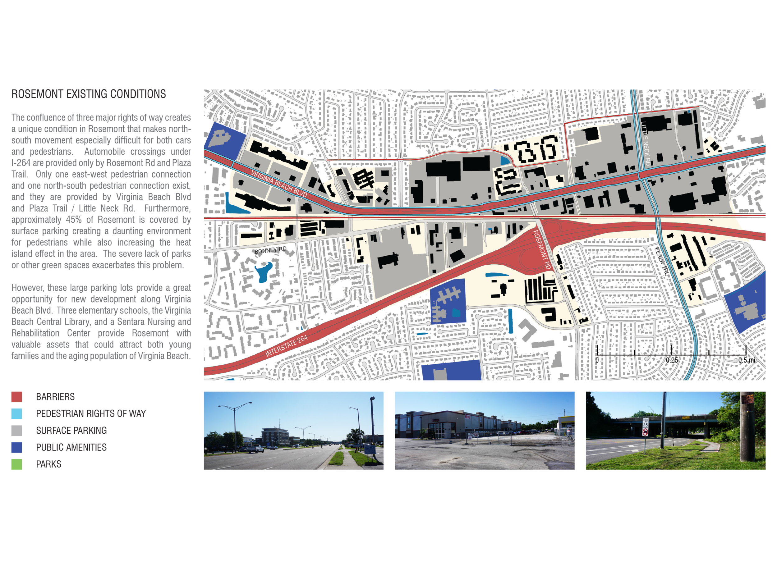
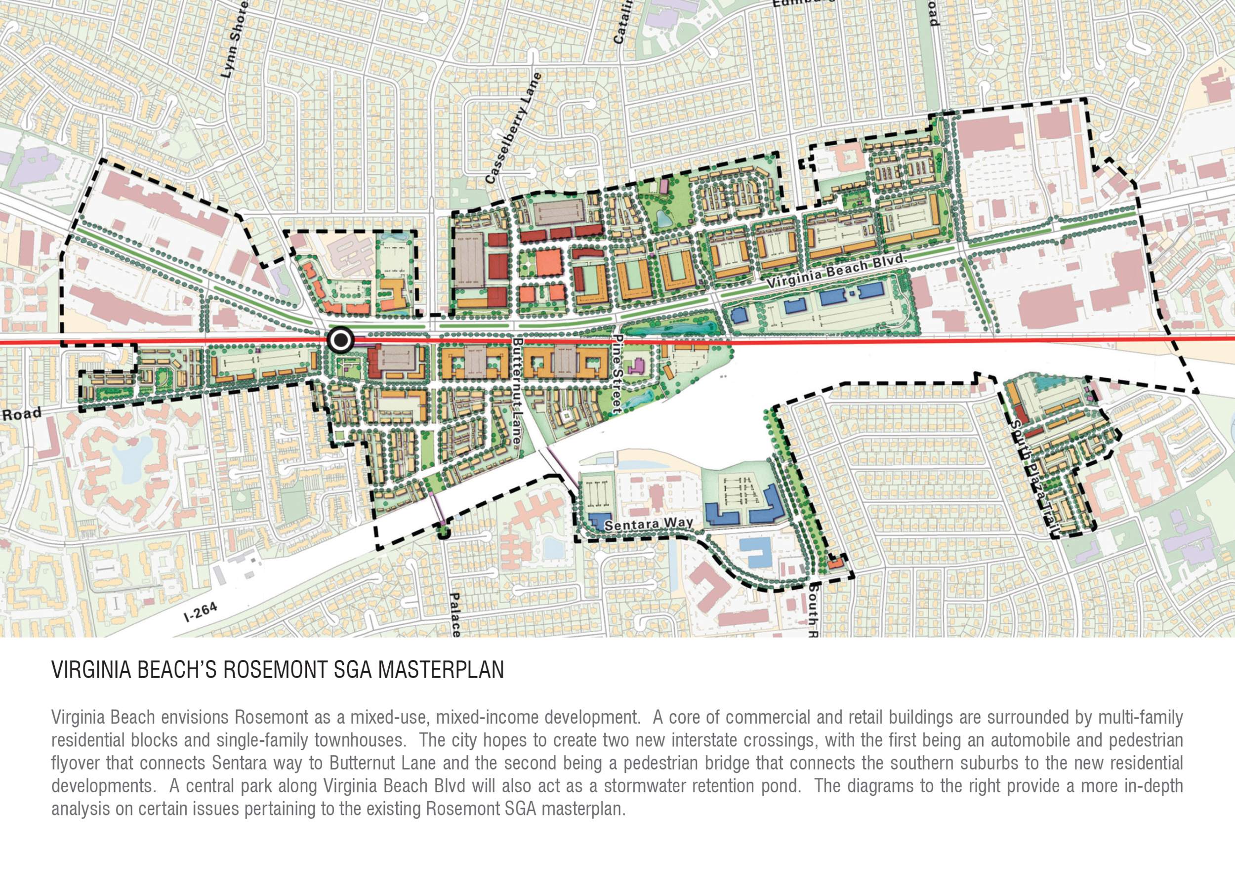
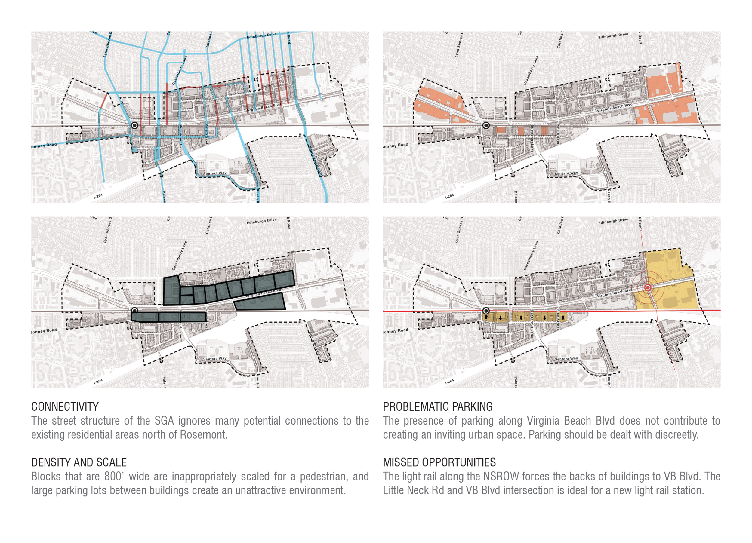
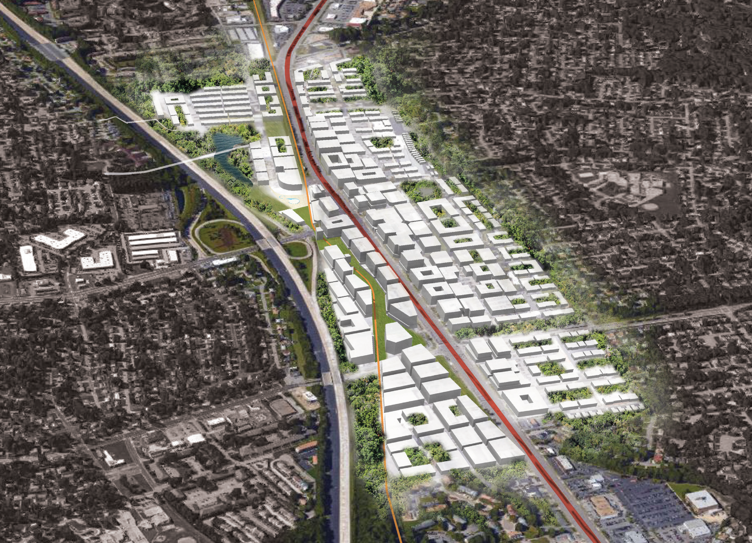
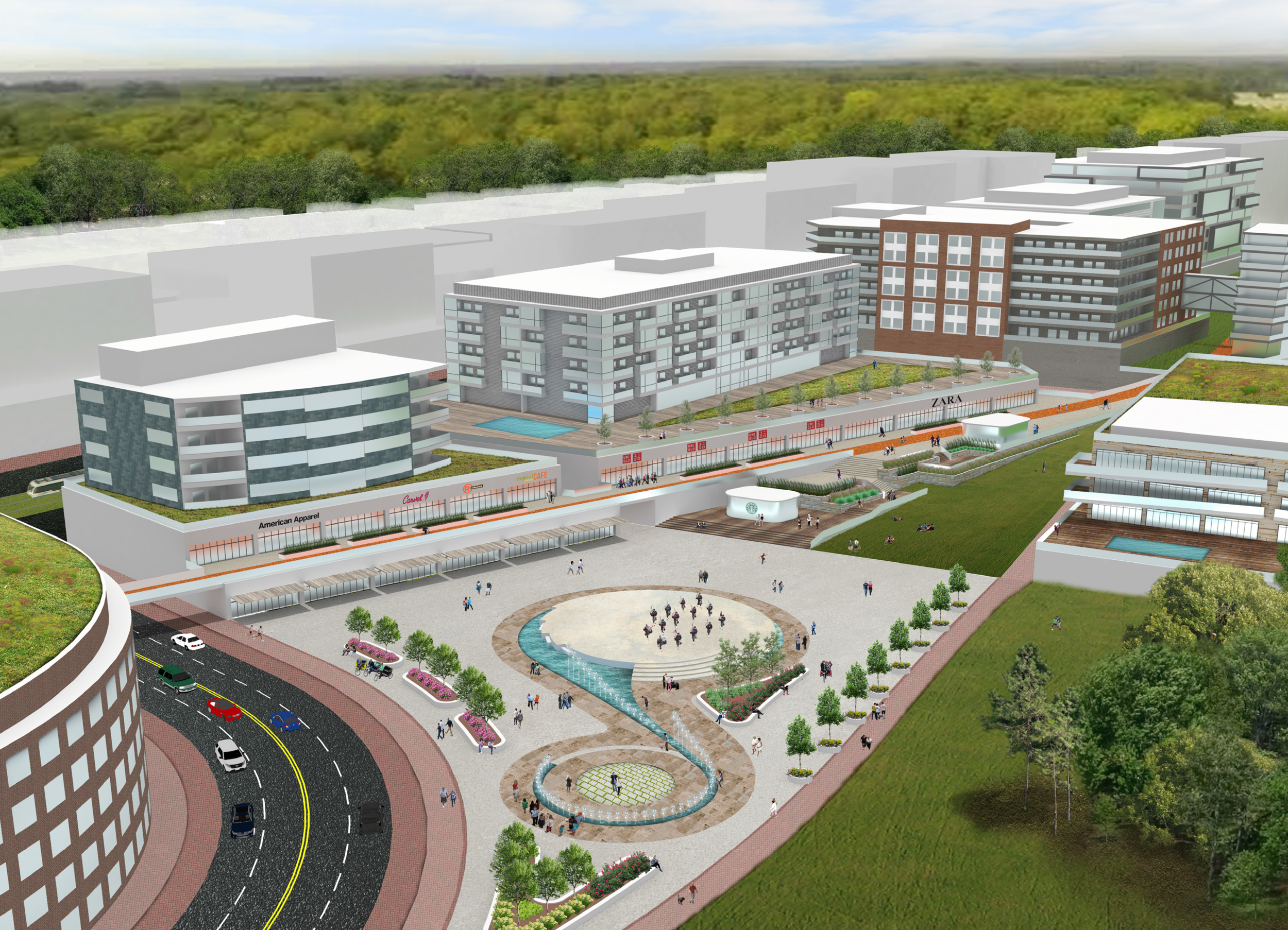
ROSEMONT SGA MASTERPLAN
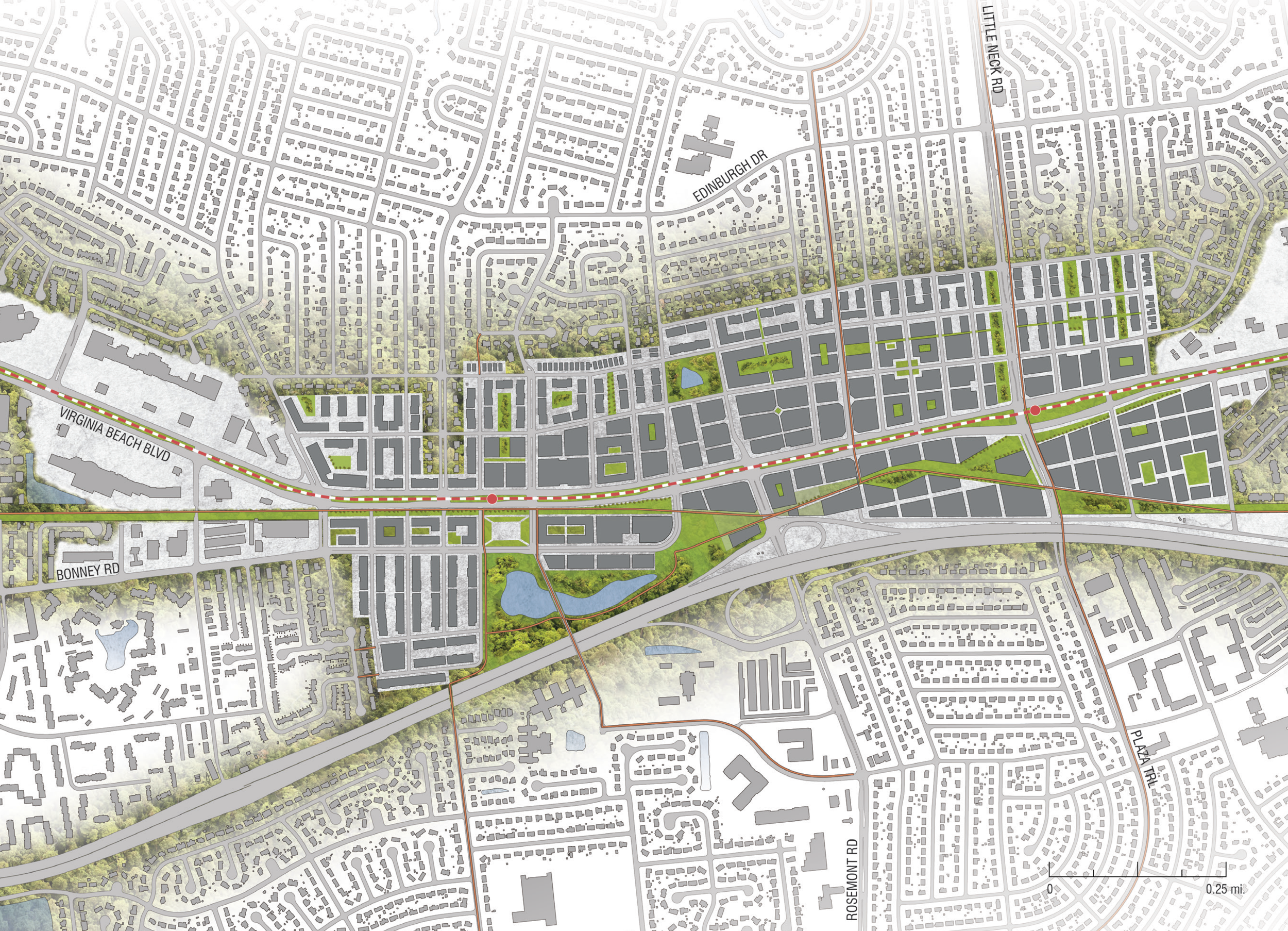
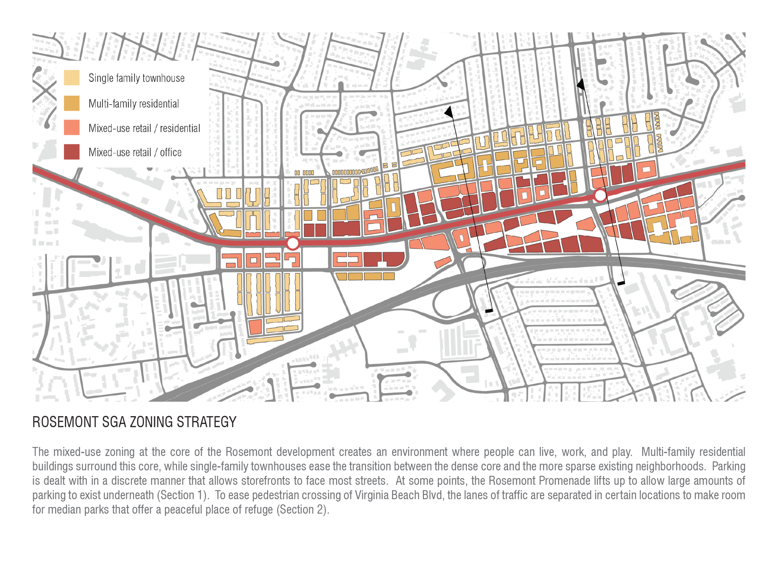
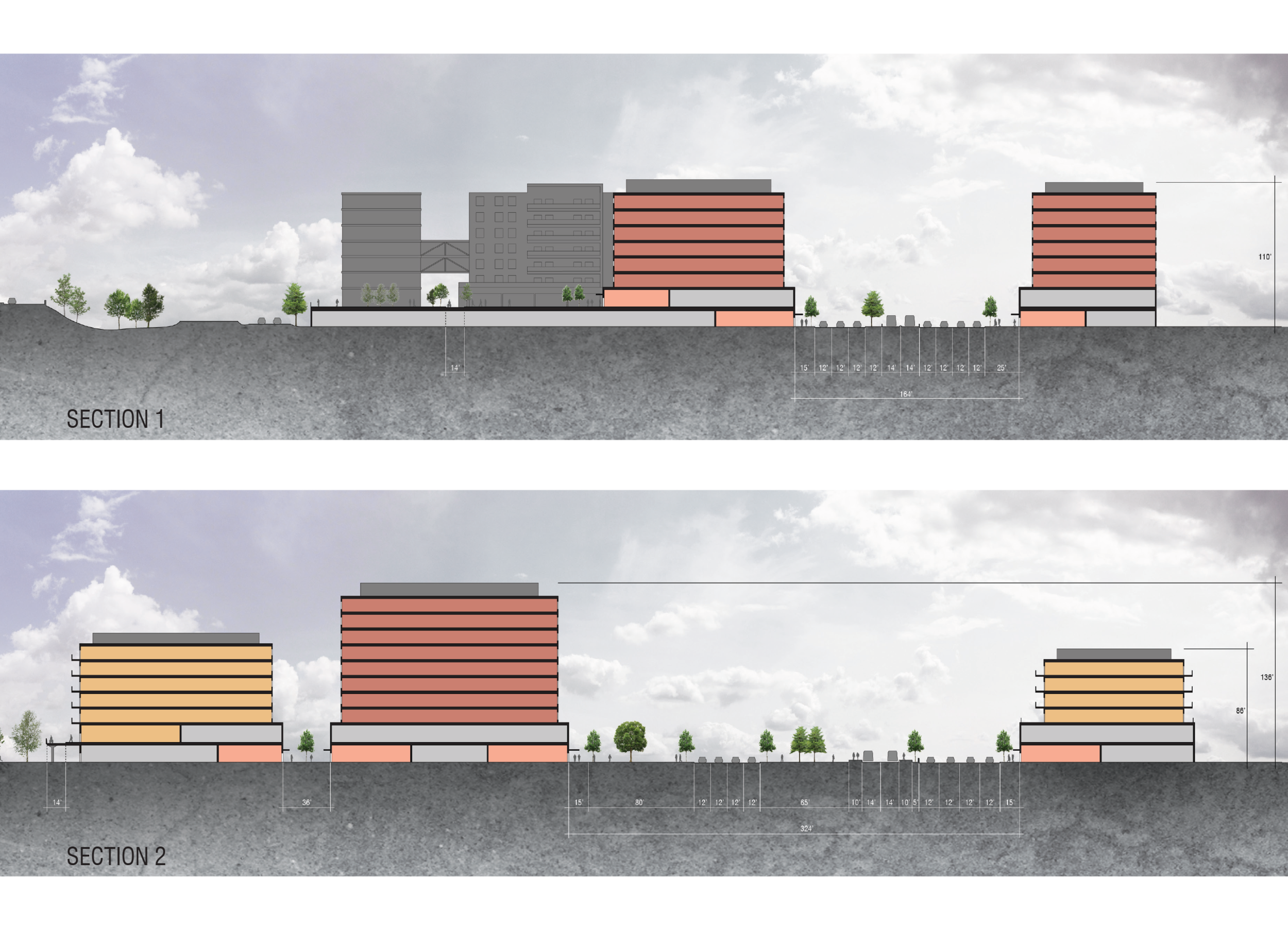
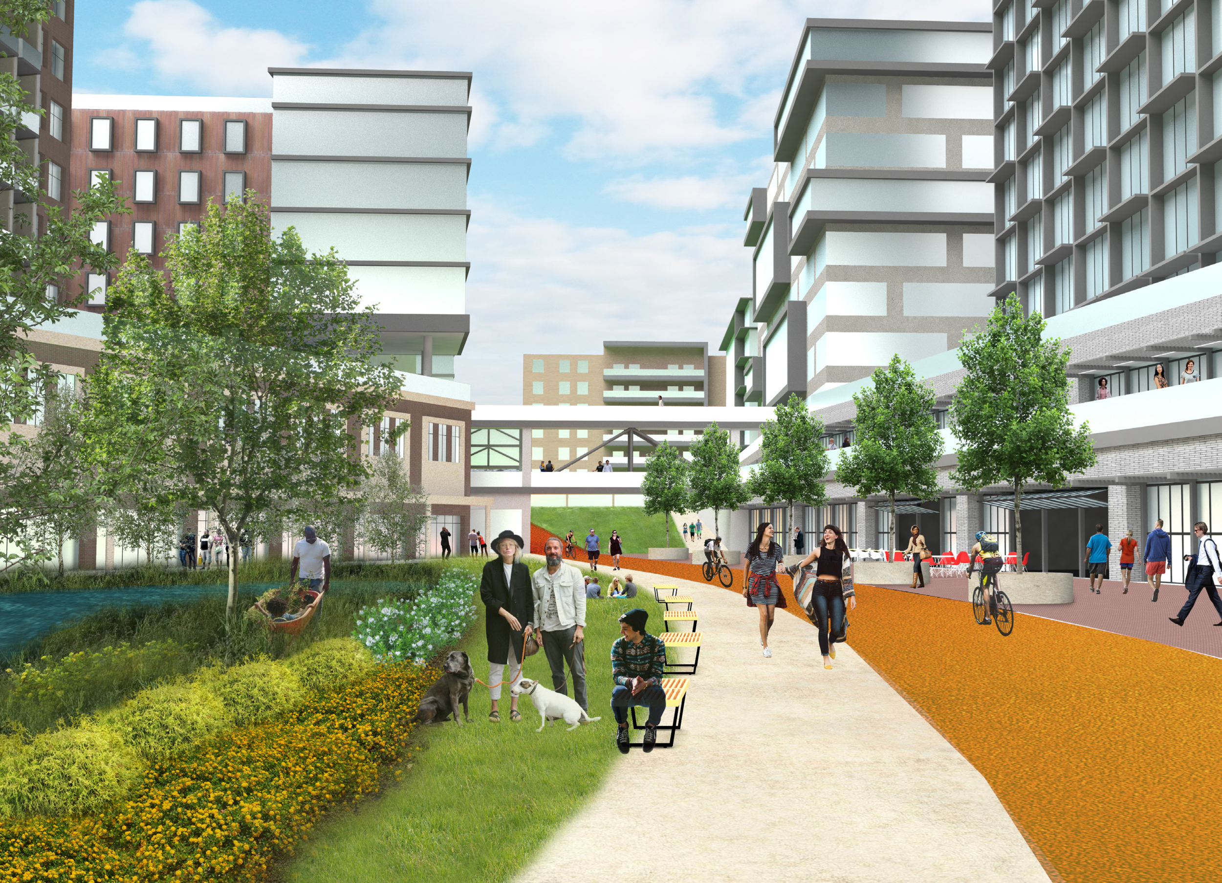
An example of one of the SGA transit oriented masterplan proposals can be seen below. Rosemont, which is currently a car-centric commercial zone characterized by a sea of oversized asphalt parking lots, has the potential to become a mixed-use pedestrian paradise just one light rail stop away from Virginia Beach's Town Center. Similarly to each SGA masterplan, the Rosemont proposal first examines the existing conditions of the site. After a thorough analysis of the city's current masterplans for the area, many issues that were counterintuitive to a thriving pedestrian-centered development were called out and addressed in a new TOD masterplan. This plan is accompanied by zoning strategies and vignettes of a completed development to give readers and local residents a sense of the benefits of TOD to their neighborhood identity and economic vitality of the area.

For full documentation of DENCITY: Easing Virginia Beach's Growing Pains through Transit Oriented Development, see below: